Adventure #11: Federman and Sharon

As usual, the winter months were not the easiest to 1) find the time to go on adventures, and 2) be able to find abandoned places under the snow!  But this year we did manage, after Christmas, and thankfully the weather was relatively nice.  We decided to stay close to home once again, though, since there wasn’t time for a grand adventure like those we usually take in the summer.

We headed west from Sara’s place in search, first, for a place called Federman.  There is actually not much of anything left, and not even much documented online about the town’s existence.  The most we know is that it sprung up at the intersection of the Lake Shore and Southern Michigan Railroad and the Toledo, Ann Arbor, and Northern Michigan Railroad.  It was likely originally called Monroe Junction, which makes sense given its origins.  Even Roadside Thoughts couldn’t really figure too much out about it.

We found what is the likely spot and took a couple of photos.  There really isn’t too much there, and where the actual railroads cross isn’t accessible by car.

Everything around it was just farm land.  As a result, we didn’t really spend a lot of time here.  Still, it was nice to check it off our list.

We then carried on north and west to Sharon.  We found Sharon on a list of potential ghost towns in Michigan and decided to explore.  Sharon Township still exists as a governing body, and we were able to locate a few cemeteries.  The first one we encountered was the most intriguing by far–in no small part because we couldn’t figure out what it was called!  There was no sign and it felt very much in the middle of nowhere.  It’s northwest of Manchester at the T-intersection of Sharon Hollow Road and Sharon Valley Road.  It’s got about 260 interments, according to FindaGrave, and most interestingly, one of them was a Revolutionary War soldier!

IMG_20190105_165333024_HDR

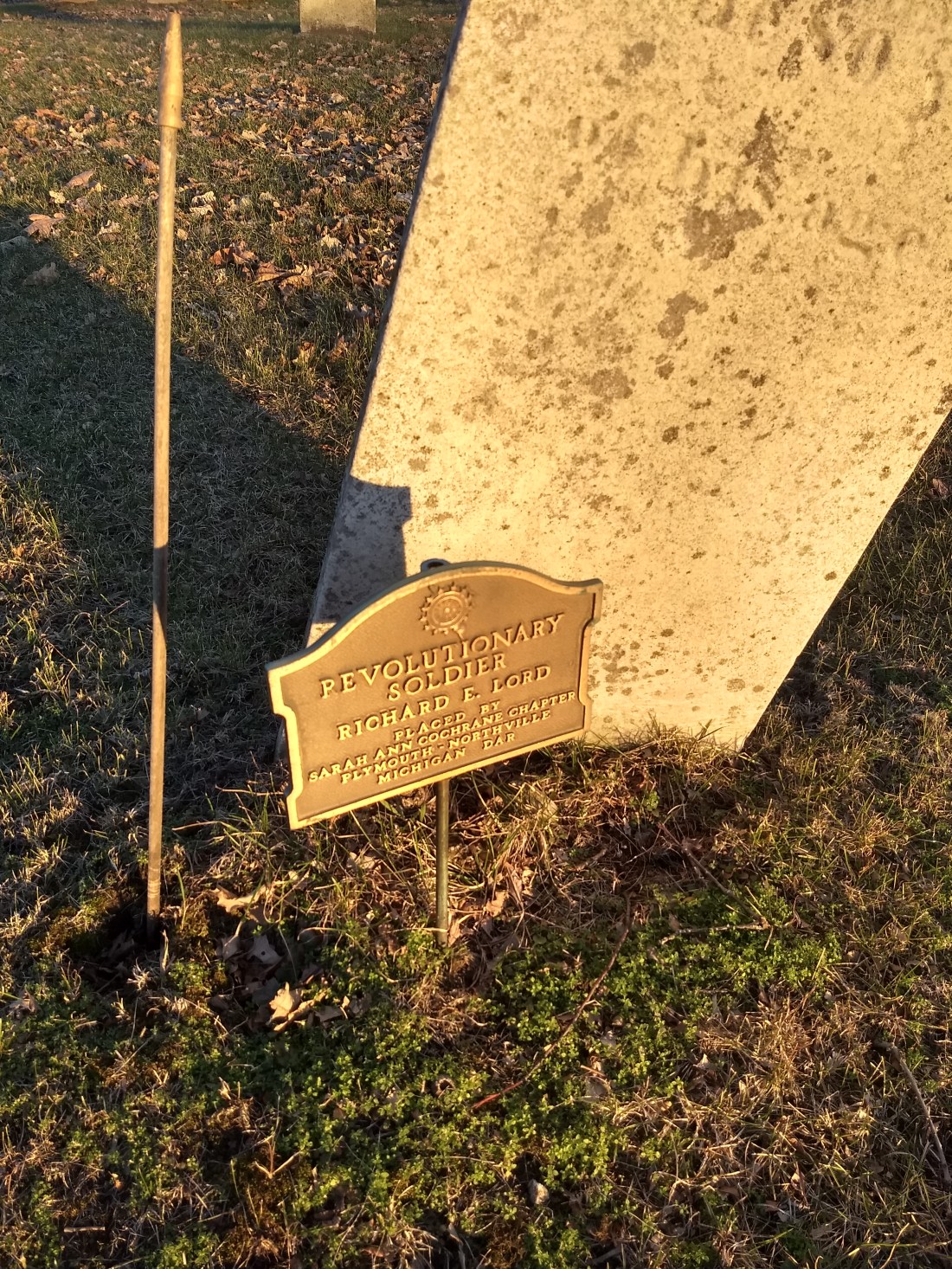
Finding this grave struck up our interest in Revolutionary War soldiers in general (assisted, of course, by our mutual love of the musical Hamilton and the fact that we’re just history nerds), so that may become a side quest for us–it seems relatively easy to find the location of known Revolutionary war interments by searching online, so we may start photo-documenting them as we’re able.

We set aside the mystery of who was responsible for this small, unmarked, but remarkably tidy cemetery and moved on to see what we could find of Sharon.  We did locate the town hall and adjacent Sharon Township Cemetery, which appears to be the primary cemetery for the area.

The first thing that strikes a person upon locating this place is the enormous memorial to Abraham Lincoln.

IMG_20190105_170750910

This memorial also included a detailed list of Civil War soldiers from the area who had lost their lives–down to the cause and location of death, in most cases.

This slideshow requires JavaScript.

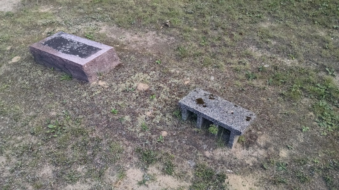
It was overall a very nicely kept cemetery, a bit larger than the one we found previously, with lots of interments dating back to the Civil War and early 1900’s.  We also found a piece of funerary art that we couldn’t identify, despite our best efforts.  We include it here, hoping someone can help us!

IMG_20190105_171027892

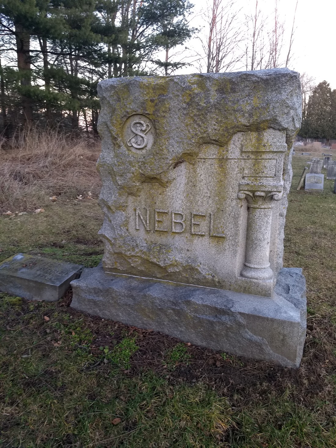
At first glance, the “S”-looking item would appear to be a monogram, but clearly that doesn’t match the surname listed on the stone.  We weren’t able to figure out what the symbol could mean–all help is welcome!

We also weren’t able to find out a whole lot about the history of Sharon online.  Sharon Township is still a relatively “live” area.  At this point, it was getting far too dark to continue, so we headed home.  However, we did contact the Manchester Historical Society to try to figure out the mystery of the tiny, unnamed cemetery.  They responded very quickly, actually, to say that it is called Gillet Cemetery, named for Amasa Gillet, a founding member of Sharon Township.  It’s also called Sharon Hollow Cemetery.  Gillet’s historic farmhouse is apparently about a quarter mile away, although we didn’t encounter it on this trip.  We’re hoping to keep in touch with the historical society to learn more about Sharon!

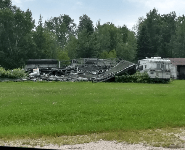
We were able to snag this one last photo on our way out of Sharon, though:

IMG_20190105_173728328

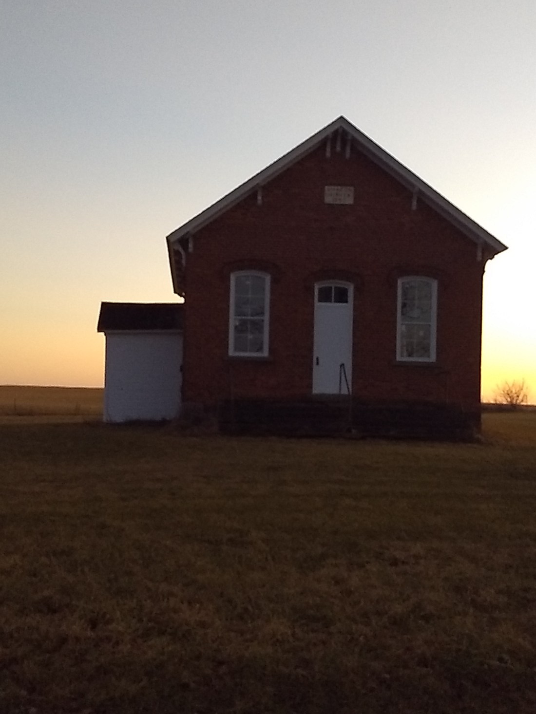
We have no idea what house this is, but it seemed appropriate to add to our adventure!

Our big adventure this summer is actually not necessarily going to be Michigan-based…we’re traveling by car to New York City!  We’re hoping to find all kinds of interesting things to add to our blog–including things that aren’t necessarily abandoned, but definitely historically significant (I’m just saying, we’re staying in Weehawken, NJ, near the spot where Alexander Hamilton and Aaron Burr dueled in 1804).  We’ll keep you posted!

Adventure #10: Cliff, Phoenix, Delaware, & Mandan

Our goal on this day was to make it all the way up to Copper Harbor (that’s the northernmost point of Michigan, for those not from around here) and then hopefully back down to see some more ghost towns before heading east along the southern part of the UP–perhaps staying in Iron River or Escanaba, we hadn’t really planned.  We knew this was rather ambitious, but we did our best.  We didn’t realize that a lot of time would be spent on the very first stop of the day, though–and in the best way!

So you know we like a good adventure, and you know we aren’t always great at following the rules (because that usually takes all the adventure out of it, really).  We also realize that AAA might put out a bolo on us if we get into anymore antics.  We have also started a list of things we really need to start bringing on our trips–flare gun, machete, water shoes, etc…

Anyway, our first destination was Cliff, MI, which is not related to Cliffs Shaft, but was also a mining town along US-41.  It’s not very far north of Calumet, and there is very little left of it–no buildings to speak of, just a slag heap here and there.  But we knew there was a cemetery around, and we were bound and determined to find it.  According to our directions, we needed to turn left on Cliff Road, just before M-41 turns into M-26.  We found that fairly simply, and we could see a trail off Cliff Road that seemed to take us right where the cemetery would be.  However, it looked like this:

IMG_20180812_122054989

We had a good laugh at what AAA would say if we called them (again) to tell them we were stuck in a shallow creek in a town that doesn’t exist anymore.

We weren’t really prepared to walk across the water, so we went down the road a bit to see if we could find a way over it.  Sure enough, there was a small footbridge where the creek was very narrow, so we thought it would be easy from there to find the cemetery.

First, we climbed a slag heap, but then realized it didn’t go anywhere and we’d just managed to increase our elevation and not much else.  So we climbed back down.

Then we thought that behind the slag heap there might be a path into the woods to the cemetery.  Well…we were wrong about that too, but that didn’t stop us.

Yes, we made our way through the woods–real woods, no paths, no clear way to anything.  Trees and foliage and brush.  We couldn’t cut around the outside of the woods because the area around the creek was too marshy.  Google Maps says that we walked about a quarter of a mile, but it was probably a lot more than that since we couldn’t take a straight path.  It was definitely up there on the list of not-entirely-rational things we’ve done, but once we were so far in, we were committed.

And we found it.  It was an incredible sight.  The cemetery is dated to around the 1860s and it doesn’t seem like it’s been touched since then.  The only indication that there is even a cemetery there is some run-down, knee-high garden fencing.  There are fallen trees, brush everywhere, just like any other area of the forest…but with headstones.

This slideshow requires JavaScript.

Findagrave.com indicates 43 interments on record…we only saw a handful of stones.  We’d assume vandalism or theft made off with the others, except the location is so remote and hard to access (not to mention it didn’t look like anyone had been there in decades or more), it seems so unlikely.  It’s inaccessible by car, and who would want to carry off a large, antique headstone?  The other possibility is simply erosion.  The entire cemetery is on a slope down the side of the mountain, with a small bluff at the end, so there may have been more stones down there that had slide down over time.  We got pictures of all we could, and it looks like someone else was there five years ago who got a few more than we did.

Of course, after this excitement, we had to make our way back to the car.  It’s times like these that you wish there was better cell service in the UP, because we couldn’t use the GPS on our phones very accurately and we’re pretty sure we took longer getting back than we did on the way in!

It was hard to top that right off the gate, but we pressed on to the nearby Phoenix, MI, which is again one of those little towns that you’re not sure is a ghost town

There were some buildings there still, and some obvious residents; there is a church on the corner of M-26.  There may have been an additional cemetery nearby, but we didn’t find it.

We did, however, turn the corner at that church (M-26, heading toward Eagle River) and ended up finding one of the best-tended cemeteries we’d ever seen.  This doesn’t technically count as a ghost town or anything abandoned, but it was such a delightful stop that we had to share some pictures of the Eagle River Cemetery:

This slideshow requires JavaScript.

We then headed on to Delaware.  We had heard that there were abandoned buildings there to find, but we couldn’t find much other than the Delaware Mine Museum.

IMG_20180812_140721555

Information gathered at the mine and online showed that Delaware was a town that just never saw its potential fulfilled.  It was founded in the 1840s as one of the first copper mining towns in the Keweenaw Peninsula and grew to a population of over 1,000.  But the price of copper dropped and the mine didn’t have a significant enough output to be profitable.  Many people, including the well-known Horace Greeley, lost a lot of money on the mine.

IMG_20180812_145705311_HDR

After our earlier tromp through the woods, we were a bit exhausted at the thought of clambering around anymore, so we called it good, not venturing into the forest for the prospect of ruins, and decided to continue on.  We did find a couple of houses on the main road on our way north, though:

IMG_20180812_150900460_HDR

There are some pictures of what others found here.  We continued north to Mandan, and we weren’t disappointed!

IMG_20180812_154339969_HDR

As you can see from the above picture, Mandan was easy to find!  Probably one of the easiest we ever located.

According to our research, Mandan underwent two periods of boom before finally succumbing to ghost town status.  The town was originally organized in 1864 to tap into the copper stores running through the area, but it was difficult to extract the ore due to some layers of sand in the soil.  This same soil quality also made it difficult for gardening and otherwise obtaining fresh produce to feed the population.  The mine was closed 1866 and remained dormant for about 30 years, until the Keweenaw Mining Company purchased that and the adjacent Medora mine to try again in the early 1900s with more modern mining equipment.

It proved to be a difficult area to populate, thanks in part to the soil, as previously mentioned, but also due to the inaccessibility of the location.  All supplies had to be brought by boat, but this was only possible May-November.  The winter was a long, hard stretch and deprivation and shortages were very common.

In the end, the mine did not prove to be as fruitful as predicted, and the mining company slowly decreased operations until 1909, when they stopped completely and the area fell into abandonment.

Some of the old building still exist, as well as some stone foundations.  A few have been rehabilitated and appear to be summer homes for people today.  Here are some of the pictures we found:

This slideshow requires JavaScript.

Of course, we speculated about whether these homes had running water or electricity–there certainly wasn’t much going on up here!  But it was a truly beautiful area.

That was our last stop of the day before reaching Copper Harbor.  We had originally planned on getting down to the southwest part of the UP, but we’d spent so much time at Cliff and the other areas that our day was complete.  We ended by driving up to the top of Brockway Mountain to take the scenic way back south and try to get as far east as possible so that we could get home the next day for other things we had to do.

There is still so much to explore in the UP, so we will definitely be making another trip up there to see what else we can find!


Adventure #9: Cliffs Shaft, Baltic, Atlantic Mine, & Boston

Day 2 of our big UP adventure began bright and early as we headed west towards the Keweenaw Peninsula.  We started with a tour of the Cliffs Shaft Mine in Ishpeming.  It really is a great facility, lovingly restored and outfitted with exhibits about mining–not just at Cliffs Shaft, but other nearby mines like Empire and Tilden.  As a bonus, the local rock and mineral society has its exhibit there, too, featuring all kinds of artifacts mined in the area (in addition to those from elsewhere).

We got to go into the mine itself, led by a garrulous guide whom we have dubbed “He Who Should Stop Talking.”  This is just the entry shaft that takes you to the cage area, where miners and equipment would come in and out.  The shaft itself has been capped with two feet of cement, so really this area just resembled a large box more than anything else, but it was interesting to hear the history of it.

The mine was started in 1879, after some exploratory drilling, with two shafts.  Back then, the town around it was called New Barnum.  In 1919, the owners decided to replace (well, actually cover) the old wooden headframes over the shaft with something more attractive, and thus the distinctive Egyptian Revival concrete obelisks were created.  They stand 96 feet tall (although one is a little shorter, having sunk into the ground somewhat).  In the 1950s, C shaft was added in between the two original shafts.  This one looks much more modern and much less artistic.

This slideshow requires JavaScript.

The whole mine was capped in 1967 once it became unprofitable, and the whole area was left to ruin.  Then local citizens, including former miners, asked the Cleveland Cliffs mining company if they could have the property to renovate into a heritage museum.  The museum now celebrates its 15th anniversary this year!  More information about the museum may be found here.

We spent a bit longer at Cliffs Shaft than intended–we had lofty goals of getting to Calumet that night and seeing several ghost towns along the way, so we chose to bypass Greenwood (outside of Ispheming/Negaunee)–in particular because it didn’t look much like a ghost town–and head straight to the next on our list, which was Baltic.

Baltic, or what’s left of it, is about six miles southwest of Houghton on M-26.  Our research shows that it was a mining town producing copper ore starting in the late 1800s.  Unfortunately, by 1931, the mine had given up all that it could, and it was shut down.  The town’s heyday was in the early 1900s, with a population recorded at 3,000 by 1918, and they had their own post office, general store, and physician.

We found some old mining buildings, as well as foundations hidden in brush.

This slideshow requires JavaScript.

Not too far down the road, headed towards Houghton, was Atlantic Mine (we marveled on this trip about how literal all the names of things are in the UP).  This town still has residents, but bears a lot of the vestiges of earlier mining years.  The first building we encountered was St. Mary’s Hall, built around 1885 and still used today.  You can also see some sort of mining relics further back on the property.

The town itself was settled around 1865 and was a very functional, full town at its peak, with a saloon, an opera house, a butcher, and more.  However, the mine was only ever modestly profitable, and the town started into decline in the 1930s.

We also got in our first cemetery of the trip, and it did not disappoint!  What we hadn’t realized was how much our Upper Peninsula was populated by people from Finland, Sweden, Italy, and Cornwall (although we knew about the Cornish presence from the prevalence of pasties).  The vast majority of the cemetery was Finnish, with some headstones actually inscribed in that language (we had to look up the words, most of which were words like “mother,” “father,” “husband,” and “wife,” as well as some scriptures).  The cemetery had some newer interments, but many were older and ran in families.

This slideshow requires JavaScript.

On the way out of town, we also found the original post office and fire station.  A couple of the original churches are also still in town.

While not a ghost town, per se, we did swing by the Quincy Mine ruins, north of Houghton/Hancock.

This slideshow requires JavaScript.

Our last adventure of the night before getting to our hotel in Calumet was finding the “town” of Boston (also called Boston-Demmon).  This area is north of Houghton on M-41; you take Boston Road off of that to find it.  According to our research (and it was hard to find very much), it was possibly a logging town.  There is very little left there; just a few residents and a couple of ramshackle buildings.

There is a road sign to a town called Salo, although that apparently no longer exists due to a massive fire.  We didn’t take the time to investigate if there were any remains; we did find one or two pictures online of a township hall.

The area’s big (literally) claim to fame is as the home to “Big Louie,” AKA Louis Moilanen, a young man who lived there and worked in the local mines.  He grew to 8 feet four inches tall and weighed over 450 lbs. when he passed away at age 26.  Apparently one of his suits is on display in Calumet.

At this point, we were quite exhausted from the day’s adventure and made our way to our hotel for the night.  And as a highlight of our trip, we headed over to Gay, MI to have dinner at the Gay Bar.

IMG_20180811_210056278_HDR

Little did we know what would be in store for us the next day…

Adventure #8: Ozark, Emerson, & Shelldrake

It’s summer in Michigan and what does that mean?  Time for Issa and Sara to make a grand adventure!  We’d been planning this one for some time, since we knew that there are many, many ghost towns and abandoned places to be found in Michigan’s Upper Peninsula.  In fact, there were (are) so many that we didn’t even try get to all the ones that we knew existed, and rightly so, because with all the crazy twists and turns of our trip, we didn’t even get to see all the ones we planned to see.  We still saw a lot, though, and have returned to tell the tale!

On Friday morning, we headed north over the Mackinac Bridge.  The first thing we noticed as we began our UP adventure is that what qualifies as a “ghost town” and what is actually still a town is a very flexible situation.  Many so-called “ghost towns” are still on the map and may still have residents year-round.  Also, what is “old” and what is “new” is also quite blended together, with towns declining and re-flourishing in different ways over the years.  Therefore, we had to use our best judgement about what to spend time on and photograph, especially given the limited nature of our time up there.

For instance, we passed through Moran, MI on Highway 123, not too far north of the bridge.  Our research had led us to believe it was a ghost town, but it seemed to be just a small village—perhaps not thriving, but still there and holding its own.  We decided not to take pictures there for that reason, and carried on further on 123 to Ozark.

This was a ghost town worthy of the name.  Turning left on Ozark Road took us to all that remains of the town, which is not much.  We saw a house or some such structure that had been recently razed—lots of detritus on the ground.  This was apparently the last original house left from Ozark, although next to the rubble was a private residence of indeterminate age.  We took our pictures of the place and left them in peace.

Ozark_1

In doing our research, Ozark was founded in 1875 as a lumber town, and was originally called Johnson.  It thrived in the early part of the 1900s, but by the mid-1960s, it petered out.  It appears that other towns closer to the mainland, like Saint Ignace or Sault Ste. Marie, might have thrived instead.  We also found the town’s Facebook page, which has some great historical photos on it.

After Ozark, we had to make some priority decisions about where to go next.  Seewhy and Soo Junction were both potential candidates, but a little research yielded that not much was left in either town, so we moved on to more promising sites.  We do hope to visit them in the future when we have a little more time.

Our next destination kept us heading north on Highway 123 in search of Emerson and Shelldrake.  There really wasn’t much of anything in Emerson to photograph, unfortunately.  The town was apparently founded in 1882 as a lumber town with a healthy fishing industry as well.  However, after both industries ran out, the town faltered and the land was eventually given over to the State of Michigan as part of Tahquamenon Falls State Park.  There was a sign for the town, but not much else.  The real excitement began when we went looking for Shelldrake.  This town was the first ghost town in Michigan that Issa ever heard of and she’d always wanted to see it.  Our research showed that it was a great one to see—several buildings still standing, plus an State of Michigan historical marker.  The trick, as ever, was finding it.

We had some fairly specific directions on how to get there—once you’re north of Paradise, turn right on Superior Rd.  There is a small neighborhood (for lack of a better term) of cottages there, taking advantage of the beautiful lakeshore.  The directions say to take a right at the first road bend, which puts you on a dirt path, and the buildings and State historial marker are on the right side.  We discovered later that this directions were accurate—however, there is also a private property sign, and we were trying our best, as ever, to honor that.  So we thought maybe the directions were wrong, or we were misinterpreting them (there is a Superior and a North Superior Road, so easy mistake).  We doubled back and tried to find another way.  This led us to….

…a junk yard.

And unfortunately, this junk yard had a very sandy dirt road.  And you know what they say about sandy dirt roads.  That’s right.  You’ll get stuck in them.

Yes, stuck.  In a ghost town junk yard.

We tried to be resourceful, independent women.  We used our resources.  We dug ourselves out of the sand as much as we could.  But it just wouldn’t work.

We called AAA.  They laughed at us.  We were laughing too, though, to be honest.

At the prospect of waiting an indeterminate amount of time and paying large out-of-pocket fees to the tow company, Issa reluctantly made her way next door to the cabins to look for help.  She also found Shelldrake.  It was right where it was supposed to be.

Shelldrake_1

We enlisted help of three men, whom we shall refer to as Old Grumpy, Unicorn Tattoo, and Beer Can.  Old Grumpy owns the entire property (Shelldrake, the cabins, and the junk yard) and was, well, grumpy about our situation.  We tried to explain that we were only looking for Shelldrake to add to our photo collection of ghost towns, but he didn’t think that was much of a reason to drive on his property (which, in fairness, we didn’t know was his and it was not marked as private property in any way).  We are unsure how Unicorn Tattoo was related to Old Grumpy, but he came along and was actually very helpful in pulling us out with their truck.  Beer Can was renting a cabin from Old Grumpy for the weekend and was the first person Issa encountered.  He was helpful enough to get Old Grumpy and Unicorn Tattoo, but then just wandered over to watch the action, with, obviously, a can of beer in hand.  We paid the gentlemen in fine double chocolate chip cookies from Goodale’s bakery in Grayling.  It was the best currency we had.

Anyway, about Shelldrake.  The area itself has been used for hundreds of years, first by Native Americans as a seasonal fishing settlement, and then by pioneers hoping to move lumber on the Tahquamenon River.  It was established as a formal (non-Native American) settlement in the late 1800s.  It had all the trappings of a fairly civilized life for northern Michigan at the time: a school house, a hospital, a saw mill, a post office, an ice house to store meat for 1,000 people, and even had hot water piped in its buildings with a sawdust burner heating the water.  There was a stagecoach from there to Eckerman, MI and a passenger ship between there and Sault Ste. Marie.  Unfortunately, a fire at the saw mill in 1925 brought about the end of the town’s industry and ultimately the town itself.  The land was purchased by a private owner in the 1930s and the historical marker erected.  While there may have been plans at one point to turn the area into a resort of some kind, all that ever came of it are a series of cabins that can be rented by Old Grumpy.

So, it was a very eventful first day of our adventure.  Three ghost towns, a few hours stuck in a junk yard, and ending the day visiting the Great Lakes Shipwreck Museum at Whitefish Point and Tahquamenon Falls on our way to Newberry, where we had a hotel reservation (yes, we learned our lesson from last year).

IMG_20180810_185744082_HDR

Adventure #7: New Rochester

Awhile back, Issa learned that there might be a ghost town much closer to home than she realized.  Otsego, MI was predated by another town called New Rochester, which set up on the banks of Pine Creek (a tributary of the Kalamazoo River) in the 1830s.  The town’s founders included Hull Sherwood, Giles Scott, Turner Aldrich, and Samuel Foster, and of course their families.  It’s also sometimes called Pine Creek, and was also recorded as the village of Dent after they got their own post office.  They felt that there would be sufficient water power from the creek, so they established a mill and other staples of a community.  However, as the nearby towns of Otsego and Plainwell found, the Kalamazoo River actually provided much better power, and those towns grew while Pine Creek waned.  Eventually, the creek was dammed, and the town abandoned under the water in 1913.


A very detailed write-up on the town’s history can be found here.  However, it is a little dated, and some information is no longer accurate.  For example, there aren’t any more buildings remaining from New Rochester that we could find.  The write-up does indicate that you might be able to see the foundations of the mill when the water is low, but we didn’t see anything.

All that’s left now is a small cemetery on the east bank of the creek, indicated on the map below:

2018-08-07_1015

Pine Creek cemetery is difficult to find if you don’t know where to look.  We knew the general location thanks to a website dedicated to it, but when you drive south on 19th Street, all you can see from the road are private residences.  We didn’t want to trespass, but we knew that the cemetery had to be behind the homes on the bluff.  We pulled into one long driveway that we couldn’t see the end of (hoping it was maybe a drive to the cemetery), but ended up next to someone’s pole barn!  The cemetery was visible from there, though.  The man came out and kindly explained how to get to the cemetery directly–on the opposite side of his pole barn is a “driveway” that isn’t even paved or gravel–just grass, so it was easy to mistake it as just more private property.  He also quite generously told us to just drive over his yard to get to the cemetery, so we did!

There’s no entrance sign or anything else that indicates to the outside world that there is, in fact, a cemetery here–just headstones.  This website we found has a list of the interments on record, and we found pretty much all of them–although the stones were quite weathered and damaged in some cases.  Most of the interments date from the New Rochester era, although a few are as recent as the 1960s and 70s.  There are a couple of the town’s founders here, including Hull Sherwood and Giles and Olive Scott.  One of the name, Morter, is the same as one of the reporters who once wrote for the Otsego newspaper, the Union Enterprise (back then called the Otsego Union) and there is a Morter Street nearby.

There really couldn’t be a more beautiful spot for a cemetery, though; visiting in late July on a nice, temperate day, the trees made for a lovely, shady spot.  Unfortunately, reports say that erosion has affected the cemetery, and some of the graves closest to the bank of the creek have been exposed over the last fifty or sixty years (we admit we did examine the bank trepidaciously, looking for anything out of a Stephen King novel).  Many of the older stones are beautifully decorated–particularly the Scotts’.

This slideshow requires JavaScript.

We aren’t sure who cares for the cemetery, although clearly someone does–the grass is well-kept and everything’s clean.  We hope that someone at least looks into restoring some of the broken and damaged headstones.

It was wonderful to find such an interesting piece of history, right in Issa’s backyard!  In talking to some local friends, it seems very few people know that there was a town that predated Otsego.  Issa plans to raise the topic to the local historical society and perhaps have an exhibit there to honor those who came and worked hard to start a settlement there!

UPDATE:  Issa posted some of our pictures to the Vanished Otsego Facebook group, which devotes itself to historical information about the town of Otsego (many towns have these, so we may have to make a habit of sharing our findings with whatever nearby communities we visit).  Some people knew it existed, while others were surprised to hear about it.  One person commented below on this blog that there is still one structure from New Rochester–the blacksmith shop, which was moved to higher ground prior to the damming of the creek.  Issa went out and snapped a photo of it for everyone to see!  It can now be found on Jefferson Road across from 19th Street, on the right if you’re facing towards the creek.  According to our research, the blacksmith shop was originally established by Herman Jungnitch, whose grave can be found in the cemetery.

blacksmith

The Vanished Otsego group also shared that Otsego Township is currently in charge of maintaining the cemetery, but the local historical society does take time to go in and clean, polish and (when possible) repair the headstones.  They’d always appreciate more help with this, so if you’re in the area, contact them to volunteer!


Adventure #6: Plainfield, Kensington, & Rawsonville

You may wonder what took us so long to go on another adventure!  Or, if you’re from Michigan, you’re probably not wondering about that at all.  Obviously, spring and summer are the best times to go rambling around some of the most rural parts of our state, while winter would…challenging.  So now that this particularly malingering winter season is finally behind us, we hopped in the car and went for a ride!

Our first stop was Plainfield, MI, which is northwest of Pinckney.  To find what’s left, travel west on M-36 out of Pinckney, through the small town of Gregory, to the point where Bradley Road heads north.  We found a few old buildings, which were intriguing, and there are still a few families living in the area.

Plainfield, MI was founded in 1835 by three men from New Jersey, who named the town as such after the town of the same name in New Jersey.  It seemed to be a bustling town at one point, with blacksmith shops, saloons, mills, a general store, a post office, and two churches.  Now, only a couple of the buildings remain.

Just a little ways west down M-36 is the Plainfield Village Cemetery.  We were able to find the headstones for some of the town founders, and it was interesting to see that there were more recent burials (2014 was the latest we noticed) with the same family names as had been there for over a century and a half.

This slideshow requires JavaScript.

There’s no real explanation available as to why this town didn’t ultimately thrive, while surrounding areas grew.  But we do know it is one of the loveliest cemeteries we’ve seen in regards to funerary symbolism and overall gorgeous headstones.

We then made our way northeast to the ghost town of Kensington, which is outside of Brighton.  It’s a little tricky to find, since there is hardly anything left.  We took Grand River Ave., south of I-96, and headed east.  On the northwest corner of the intersection of Grand River and Kensington Road lies the only remaining piece of the town, the Kensington Baptist Church Cemetery.  The church itself was razed in the 1950s.  We visited the cemetery and while it seems kept from a grass standpoint, many of the stones are damaged and could stand to be repaired or replaced.

This slideshow requires JavaScript.


Kensington used to be a booming community that rivaled the other major towns in the area.  It was founded in the late 1820s and grew quickly, thanks to the Huron River and surrounding fertile land and abundant forests.  Kristina Austin Scarcelli did an amazing write-up on the town’s growth and ultimate demise, including a fascinating narrative about the development of a “wildcat bank,” which were common in the frontier areas of the country at the time.  Essentially, the Kensington Bank printed more bank notes than they had actual backing for, mismanaged what funds it had, and the notes ended up worthless.  Coupling that with the decision not to dam the Huron River–which caused a power shortage for the Kensington population–and the decision of area’s railroads not to include Kensington as a stop on the line, the town declined and died.

There were actually two cemeteries left behind, although the second one, located just a little bit further down Grand River Ave., is much smaller–only 30 interments listed, but even fewer stones that we could find.  It appears to be more or less abandoned and not well tended, although it’s in a beautiful spot.

Although we were running out of daylight, we decided to make one last stop.  This one we knew we wouldn’t find very much evidence of, as it’s actually underwater.  Rawsonville, MI now exists under Belleville Lake in Belleville, MI.  Founded in the 1830’s and booming during the Civil War era, apparently it fell victim to the failure of the railroad system, and then the state decided to dam the Huron River (as the citizens of Kensington had wanted!) and the city was abandoned to the resultant man-made lake.  All that exists now is a plaque in front of the McDonald’s on Rawsonville Road.

Even though there wasn’t much to photograph, we thought it important not to neglect this piece of Michigan history and honor what was there!

IMG_20180505_193836576_HDR[1]

Although we stayed close to home, it was an excellent adventure in southeast Michigan!

Adventure #5: Glen Haven, Aral, & Jacktown

We survived the night in our seedy motel, which was all that was available in Traverse City on Labor Day weekend, and headed west, deeper into the Leelanau Peninsula.  We had a couple of spots marked on the map that we definitely wanted to see.

Our first stop of the day (after breakfast, of course) was Glen Haven, which is part of the Sleeping Bear Dunes National Lakeshore.  Glen Haven isn’t the type of ghost town we traditionally visit; while it is an abandoned town, a few of the buildings are now maintained by the State and are on display for the public.  It’s part of the trails that run all through the area and makes a nice stop for hikers, bikers, or people just passing through by car, like us.

This slideshow requires JavaScript.

The place has the old canning factory, which now houses several types of boats and lighthouse paraphernalia; it’s also a good place to get some literature about the area, and/or get a lesson on it from one of the park rangers.  There’s also a general store (which unfortunately was closed when we went) and a working blacksmith’s shop–there was a demonstration going while we were there.  Also, a few old houses, some of which have interesting signs discussing the home’s past.  It was definitely worthwhile to visit, if nothing else to take in that unforgettable view:

IMG_20170903_114806670.jpg
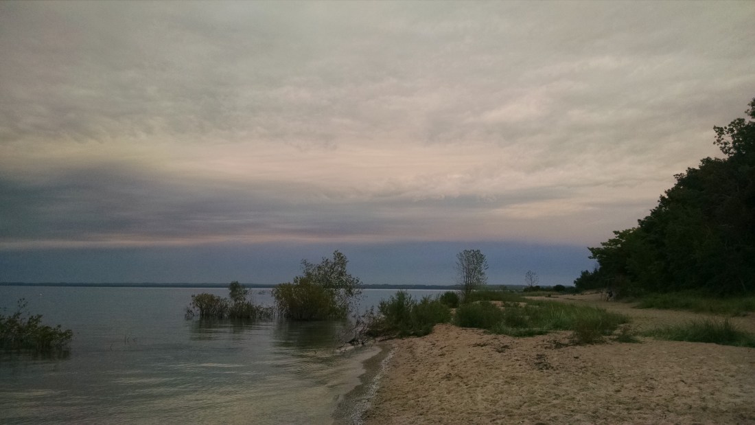
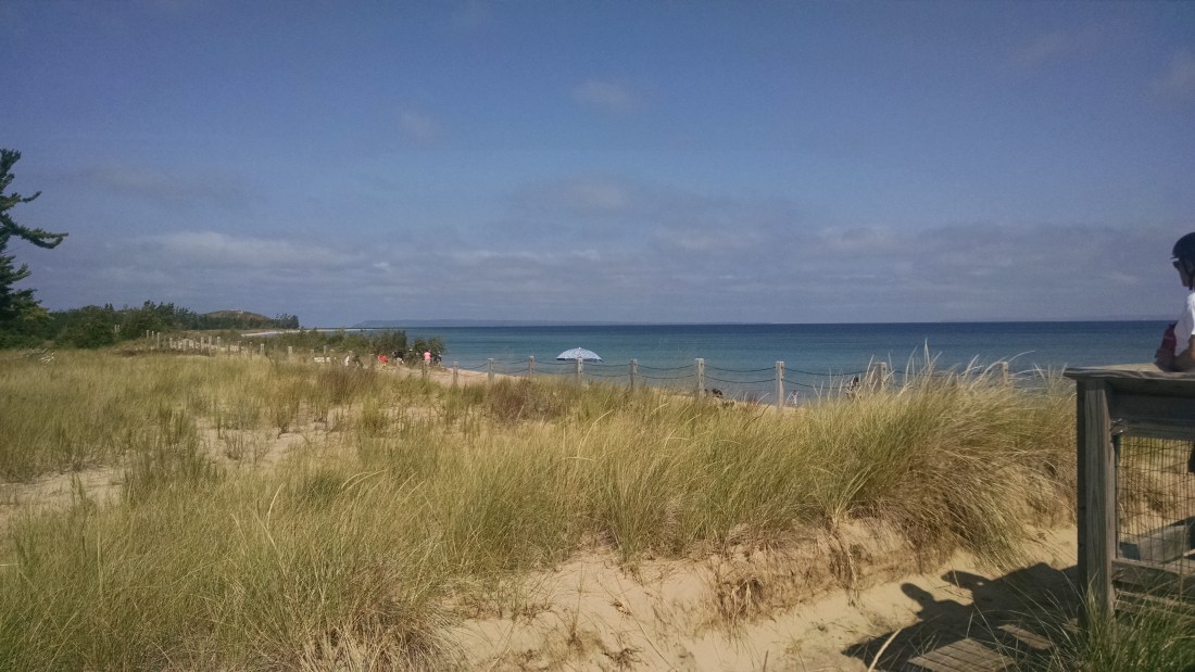
We may be a little biased, but Michigan dunes and lakeshores are honestly among the most beautiful in the world.  From this point, you can get a good look at the Manitou Islands–which we also read had some ghost towns on them, so next year’s trip is already in the making!

From there, we headed towards Aral, which we read about in a pamphlet at Glen Haven.  Unfortunately there isn’t much there.  It’s south of Empire, off of Esch Road…and apparently that’s all it is.  A road.  So nothing worth even taking a picture of, unfortunately.  We moved on.

Finally, we made one last stop in a place called Jacktown.  There is very little left of it here; the research we found is that this is just another one of those little company towns that sprung up with the growth of the lumber industry and the railroad, and died off just as quickly once the area was logged out and the railroad was dismantled.  It’s near Empire, in Leelanau county, although crossing the road takes you right into Benzie county.  To find it, we headed south on state road 677 and then turned left on Oviatt/County Line Road.  According to a few different online sources, there may be some old foundations of buildings still around in the woods, but we thought the better of exploring too much off road, since there appeared to be a relatively active lumbering site there, and there were sounds of gunfire echoing in the woods.  We stuck to locating Bland Cemetery, which is the only real remain of the town.

The cemetery is so tiny–only 18 interments on record, and not all of those appear to have stones.  The cemetery was established in 1868, and the last known burial here was in 1926, although the majority were in the late 1800’s.

IMG_20170903_140010317

As usual, Issa tried to be helpful and take pictures of anything that needed to be added to Findagrave.com, but as previously stated, not all of the headstones were there, and all of those that were there had already been posted to the website.  On Findagrave.com, there appeared to be a lot of work done to really flesh out what we know about these people–death certificates, etc. were all uploaded, so it was interesting to read the entries.  One of the most fascinating ones we read caught our eye, for one thing, because of the name: Idonia Melvina Bolt Van Wormer-Verno.  I mean, how do you even fit that on a headstone?  Apparently you don’t, because it was nowhere to be found.  An elaborate write-up on her family tree is posted on Findagrave, and the last paragraph is the most intriguing:

Four days before her death, Melvina married Paul Verno, Sr.  He buried her in a secret location that remains a mystery to this day.

(This, after having having eight or nine children and then living as a widow for some time).

So, according to record, she is supposed to be in Bland Cemetery, but there is no marker with her name on it.  She was only 42 when she passed away.  None of her children, her first husband, nor her second husband are buried there.  A quick search located Paul Verno’s grave in nearby Empire, in the St. Phillip Neri Catholic Church cemetery.  Of course, he’s also listed there as having three possible wives, some of which were concurrent, so we’re unsure what the real truth is behind this family.  Some real intrigue, though!

Here are some photos of other stones we saw there.  Most were quite simple:

This slideshow requires JavaScript.

Lots of Blands, Ames, and Huff families represented here.

As the sounds of rifles shooting in the woods were getting louder, we thought it was prudent to leave!  We made our way home, stopping in Cadillac at Mr. Foisie’s Pasties, which were excellent and we highly recommend them!  A bit of fudge from Gramma’s Treats in Baldwin might have also been consumed en route *smile*.

Overall, it was an excellent adventure–so much we saw and learned!  We can’t wait for the next one!

Adventure #4b: Idlewild and Marlborough

After our adventure in Nirvana, it seemed like the day was a complete success.  But as we continued west in search of the last small town on our list for the day, we saw a historical marker on the side of the road:

IMG_20170902_134337384

We both looked at each other in complete disbelief.  How did we not know about this?  We’re both lifelong Michigan residents and had never heard of anything like this.  Another sign close to this one pointed the way towards a “cultural center and museum,” so we simply had to go investigate.

The museum there is small, but well-appointed and full of wonderful exhibits.  The ladies working there that day were incredibly friendly and even invited us to sit down and showed us a short film that was made by a Detroit news organization celebrating Idlewild–its founding, its heyday, and its decline.  The film looked to have been shot in the late 1980s and early 1990s, so they still had many people to interview who were still alive and had memories of visiting the resort.  There’s also a good write-up about it here by the Detroit Free Press.

Basically, this resort town was created in the early part of the 20th century as a place for African Americans to vacation (and entertainers to come and perform), as they weren’t welcome at mainstream establishments due to segregation.  Apparently, if you had any means at all, you spent your summers there and it was glorious.  Nearly every major African American entertainer performed there at some point, and there were multiple night clubs, as well as more family-friendly types of establishments, too.  After the Civil Rights Act was passed in 1964, and entertainers were able to go to the more traditional spots–Las Vegas, Atlantic City and the like–the resort went into decline.  Now very few of the original buildings are there, and many are boarded up.  We didn’t venture towards the lake, as there were private homes there that some people do still live in and we didn’t want to intrude, but we did get a few pictures from the road:

IMG_20170902_134549920

We spent a good amount of time chatting with the ladies in the gift shop and viewing all the artifacts they had on display.  It was unbelievable to us that we had never heard of this place that was so important to Michigan history, and that got us into a long conversation about race and privilege.  We thought deeply about how one man in the video we’d watched talked about how his mother would pack the car full of meals for the whole family as they made the trip north from Detroit in their car.  As a child, he’d said, he just thought it was being economical; as an adult, he realized it was because there would not have been any restaurants along the way that would have served them.  They ate in the car because they had no choice.  And at the same time, Detroit was booming largely because of the labor provided by blue-collar workers in automobile factories (many of them African American) and by the growing music industry (again, inspired by and built by African Americans).

The women working at the museum said that there are efforts at present to revitalize the area and build a community center.  It is still a very beautiful place, despite the closed-up buildings; it’s northern Michigan to a tee–beautiful woodlands and a lake.  It’s a place very much worth saving.

After we finished up in Idlewild, we continue west on M-10 to the town of Baldwin (not a ghost town–very much alive!)  As became a habit with us on this trip, we realized we hadn’t eaten lunch and it was 3:00 p.m., so we made a stop and ate.  We’d also been told by the Idlewild ladies to check out Gramma’s Treats, so we walked there from our lunch spot and were NOT disappointed!  Some of the best fudge EVER in so many flavors!  The orange cream was surprisingly delicious, and the more traditional chocolates were also amazing.  Gramma herself is also very kind and even gave us each a free homemade donut for the road (also delicious).  If you’re ever in the area, stopping by there is a must!

She also gave us some information on the next ghost town we were hoping to see, which was Marlborough.  She said the area used to be well open to everyone, and she’d gone there to play and party as a youth.  She thought it was probably all blocked off now, and unfortunately she was right.  We headed south from Baldwin to find whatever we could of the place, and all that we were able to see was the old cement factory, around which the whole town had been built:

This slideshow requires JavaScript.

A Lansing-based radio station did an overview of the town, and also threw in directions to find it, which you can read here.  Here’s the thing, though; the article states that you can go through the woods to find more ruins, beyond what can be seen from the side of the road.  However, if you look at the pictures above, the KEEP OUT signs are clearly visible, as is the barbed wire fencing around the whole thing.  So I’m thinking Gramma knew what she was talking about; she also mentioned that the ground there is considered unstable from all the quarrying and blasting they did, getting materials for the cement plant.  So while we wouldn’t have necessarily been averse to trekking out into the woods in search of old buildings, it looked like it might have been more difficult (and come with legal consequences) than the author of that article imagined.

After all this excitement, we were quite exhausted!  Our plan was to check out some more spots in the Leelanau Peninsula, so we headed north to Traverse City.  We got the timing right and managed to see a Lake Michigan sunset (although unfortunately, it was a bit cloudy and rainy)!

IMG_20170902_200231782.jpg

And then began our saga of finding the seediest, most out-of-date, crappy motel to be had in northern Michigan (let’s put it this way: we got half off the room rate because there was no heat), and putting aside our fears of being captured by a serial killer, we rested up for the next day’s adventure!

Adventure #4a: Brookside, Summitville, & Nirvana

We headed out bright and somewhat early on September 2, 2017 from Big Rapids, hoping to find some interesting spots on Highway 10.  There were several indicated on the map we accessed from http://www.ghosttowns.com, and we found one that wasn’t included on there–Nirvana (which is apparently pronounced by the locals such that the “van” rhymes with “can” rather than “con”–apologies to Kurt Cobain).

Brookside was more or less nonexistent; there was nothing even to photograph.  Summitville was similarly empty, except for a long, winding road that included several sandy hills:

IMG_20170902_114528959

We drove down the road a ways, noting that only a few people were there apparently camping, and there were a couple of residences down a private drive–nothing visible from the road.  So we headed back to M-10 and proceeded west.  That’s when we found Nirvana.  And by “found,” I mean there was a sign that said “Nirvana” (which we missed the first time we passed it) and a boarded-up church.

IMG_20170902_115256264_HDR

We thought there might be a cemetery near the church, so we hunted around on Google Maps and finally found it–Cherry Valley Township Cemetery, off of Knight Rd.

This was one of the odder cemeteries we’ve ever visited; for one, there were lots of missing stones, stones with missing dates (when the person is obviously no longer living), or strange stand-ins for stones, like this cinder block:

IMG_20170902_120718075.jpg

Or a basket of fake flowers with a nametag in it.  Or just a plain wooden cross with no name on it.  That sort of thing.

There were many World War I veterans in this cemetery; we assume that’s when the area was still thriving.  There were some newer interments, but mostly older ones.  Family names like Fray and Avery.

This slideshow requires JavaScript.

Then something really remarkable happened.  As we were getting ready to leave, an older couple came into the cemetery to tend a plot of graves.  They were very friendly, pulling up behind our car (since there’s only one drive, we asked if they needed us to move, but they cheerfully declined).  After a few minutes, they realized we weren’t there for any specific person and asked us, not in any kind of suspicious way, what we were up to.  When we told them, the older man got really excited and asked, “Have you ever heard of Andy Horujko?”  When we said we had not, he led us over to a grave and started to tell us quite the story.

IMG_20170902_124214174.jpg

Andrew (Andy) Horujko was a World War II veteran who died in 2008.  He lived in the area and was known as something of a recluse.  He didn’t own a car, never married or had children, and they weren’t even sure he owned a phone.  He kept to himself, caring for some cattle on his property.  His claim to fame?  Walking from Anchorage, Alaska to the southernmost tip of South America back in the 1960s.

“Do you want to see his homestead?” he asked us.  Of course we did!

So we hopped in the car and followed them as they drove us even deeper into the middle of nowhere (because following random strangers into the mostly deserted wilderness to see an abandoned house is a perfectly rational thing to do).  We pulled up to a property that was lined with very close-planted pine trees, which formed a visually impenetrable wall.  Through the single opening in the driveway (such as it was, quite grown over), we could see a cabin-style house with the windows boarded up, a couple of barns and other outbuildings.

This slideshow requires JavaScript.

Upon a little more research, we found out that his great walk across two continents wasn’t his only achievement.  He finished near the top of his class at Michigan Tech and worked as an aeronautical engineer for one of the Wright brothers, and he was a member of the Michigan chapter of Mensa.  So, a legit genius.  Apparently, his walk was meant to protest the automobile industry and the pollution it causes.  Here’s a press photo we found of him online: https://outlet.historicimages.com/products/dfpy12415

We also read this account from someone who met him later in his life, in what appears to be a rare excursion for Mr. Horujko: http://theportableschool.com/MMMDI/RealWalker.html.

This really gets to the heart of what we’re trying to do when we go on these adventures: we love to hear (and in this case, even see) the stories of our amazing home state–the more personal, the better.  We had never even heard of this man or his achievements, and all of a sudden we were standing in front of his house, learning about him from people who knew him personally (the older couple who led us to him were his neighbors and knew him as much as anyone did, given how much he kept to himself).

You’d think this would be the real feather in our cap and our way to end the day.  But even more was in store!  All this, and we hadn’t even had lunch yet!  We were passing through on M-10 trying to get to Baldwin, MI, in Lake county, so we could head south to another ghost town on our map, but we were quite pleasurably detained at a small place we encountered on the way called Idlewild…

Adventure #3: Delta Mills, Vickeryville, & Butternut

It took a year, but we were finally able to make it out again and travel our great state of Michigan in search of ghost towns (and whatever else of interest we managed to find).

Issa and Sara set out on September 1, 2017 in search of adventure and abandoned things.  Our first stop was Delta Mills, just northwest of Lansing.  Since Issa was born and raised in Lansing, this was a fun stop for her!

Unlike a lot of other places we’d been before, this one is not at all out of the way.  Lansing suburbs have encroached a great deal, and now Delta Mills is almost seamlessly connected.  To find it, take the Creyts Road exit off of highway 496 and head north until Creyts turns into Webster Road–then, make a right at Delta River Drive.  On that corner, you’ll see the closed up mechanic’s shop, and as you proceed down Delta River Drive, you’ll see an abandoned barber shop and general store.  The church, however, is still active and is a beautiful old building.

IMG_20170901_163343140

There’s an historical marker on the corner of Delta River Drive and Ingersoll Road that notes where the old school used to be.  It’s since been torn down, unfortunately.  Just a few yards down Ingersoll Road is the Ingersoll homestead, which is a gorgeous white home.  Erastus Ingersoll was the founder of Delta Mills.

IMG_20170901_163519640

Further down Delta River Drive is Hilltop Cemetery, which has so many familiar names if you’re connected with the Lansing area.  For one, the Creyts family (hence the name of the road) and of course the Ingersolls (note: we learned on this adventure, and the ones that followed that weekend, that “Erastus” was apparently a really common male name in the mid-19th century).  We also saw a lot of graves designated with the names “Throop” and “Jarvis.”  Issa recognized several of these names as teachers and classmates she’d had growing up in the Lansing School District.

This slideshow requires JavaScript.

We learned a lot on this trip about funerary symbolism.  So many of the older graves had significant depictions on them–willow trees, clasped hands, palm fronds, doves, and also symbols attached to fraternal organizations, like the Odd Fellows.  The Cemetery Club explained a great deal to us!

The Michigan History project has done a wonderful job researching and writing up the history of Delta Mills (also known as Grand River City).  We found this website after visiting, and it shed so much more light on the area!

After we were done at Delta Mills, we headed northwest to Montcalm County to visit Vickeryville and Butternut.  These two are off of M-57, which we accessed by heading north from I-96 on M-66, then heading west on M-57.  Vickeryville is well-marked–there’s a sign from M-57 that points you in the right direction down Vickeryville Road.

The most obvious landmark is the Central Bean and Grain mill and accompanying storage shed, each on its own side of the road.  Both are open to the elements, although we wouldn’t recommend venturing in–for one thing, they’re private property; for another, the mill in particular doesn’t seem too safe to enter.  There was a light breeze as we walked around the perimeter, and even that was enough to cause parts of the mill to squeak and groan.

This slideshow requires JavaScript.

Continuing further down the road, we found the old church, which is still active; there is also an Old Order Amish settlement nearby (which we didn’t photograph, out of respect).

IMG_20170901_190725683

Then, it was on to Butternut!

This was one was tougher to find.  There’s less left, and it’s well off the main road.  We continued east on M-57 just a short ways from Vickeryville and turned left on Main Street.  We missed it the first time.  Doubling back, we turned west on a road that appears to have a few names…Google Maps calls it North Butternut Street, but the street sign disagreed.  It’s a short, dead-end road that actually sort of loops back and connects with North Street (perhaps unofficially, though…it was a moment of off-roading for us in Sara’s Prius!).  We found a large barn-like structure and an old mechanic’s shop, both heavily foliaged by this time.  There might have been more further down, but the road officially ended and was then marked as private property, so we kept out.


This slideshow requires JavaScript.

By this time, it was getting quite late, so we headed north to Big Rapids and found lodging for the night.  Shout out to Quality Inn–basic, no-frills facility with a really friendly staff!  We did begin to question our thinking of just getting a hotel room wherever we happened to land each night…it being Labor Day weekend and all…but thankfully this place had a room and excellent customer service to boot!